LANGUAGE · KR 한국어 / EN English ↓
한양도성 바깥, 북악산 아래에는 언제부터 사람이 살았을까. 오늘날 북정마을의 좁은 골목을 걸으면 낮은 집과 기와지붕, 오래된 담장이 먼저 눈에 들어온다. 그러나 이곳의 시작을 이해하려면 지금의 집보다 훨씬 앞선 시간으로 돌아가야 한다. 성곽 바깥의 생활에서 출발한 장소가 문인과 예술가의 거처를 거쳐 도시노동자의 주거지로 이어졌기 때문이다.
나는 북정마을을 약 10년 동안 여러 차례 걸었다. 처음에는 산자락을 따라 펼쳐지는 지붕과 골목의 풍경에 눈길이 갔지만, 석사논문을 준비하며 같은 장소를 다시 읽게 되었다. 집이 놓인 자리, 길이 꺾이는 방향, 대문으로 이어지는 계단에는 이곳에서 살아온 사람들이 지형에 대응한 방식이 남아 있었다.
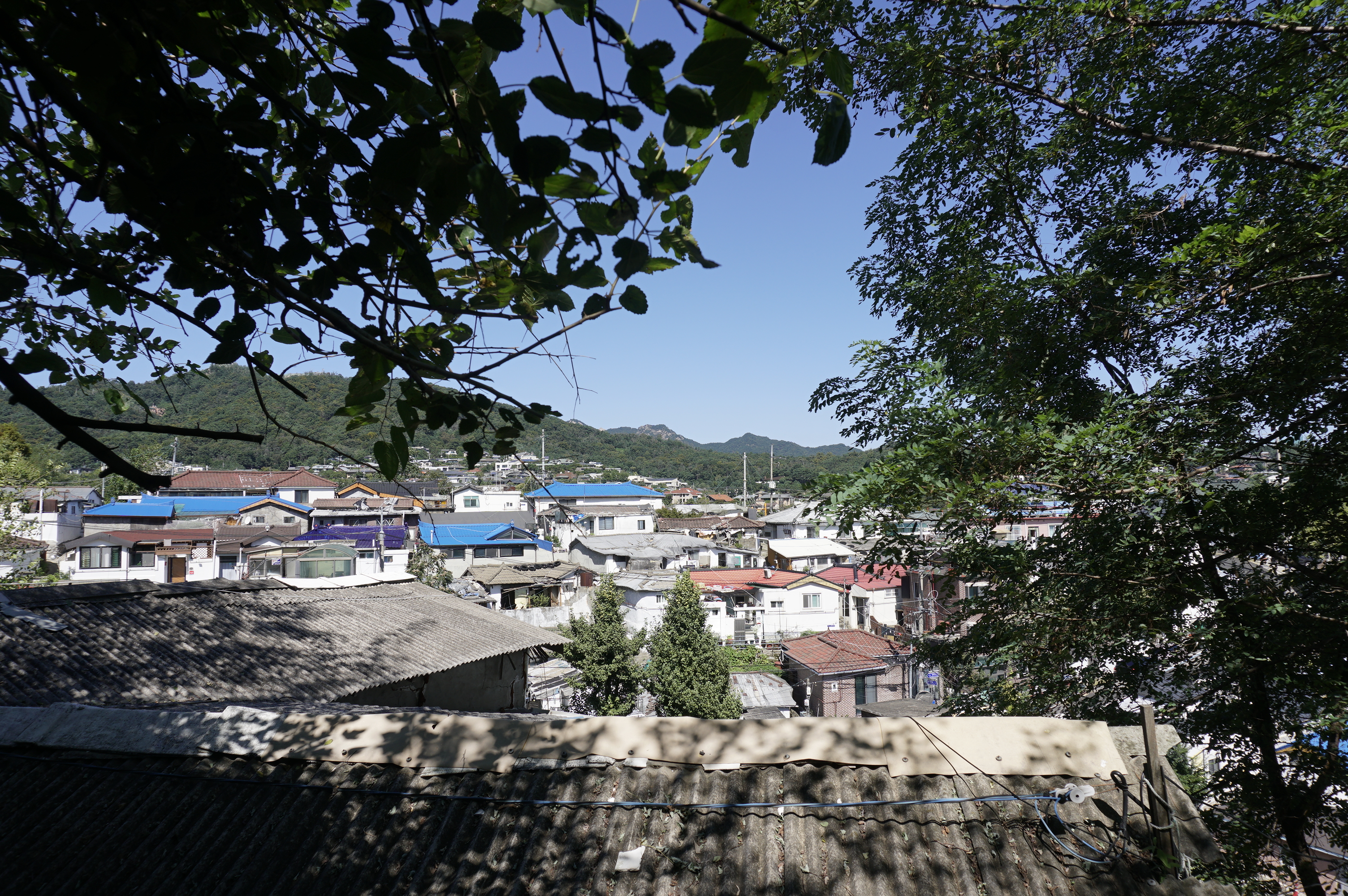
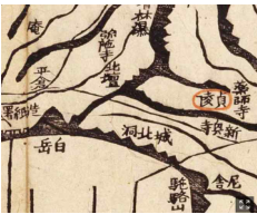
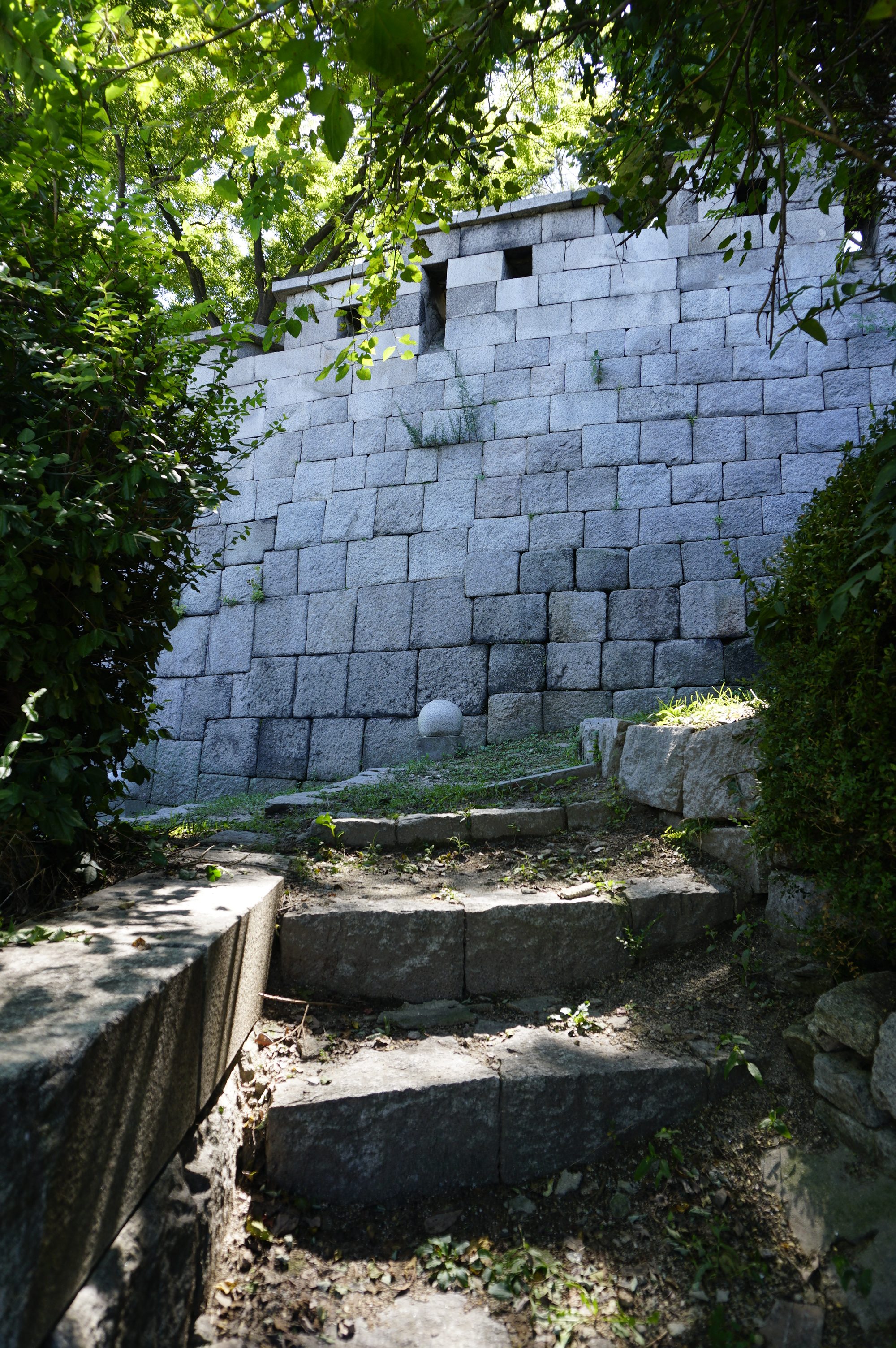
북정마을은 성북동 북쪽, 한양도성 바로 아래에 자리한다. 성곽은 옛 한양의 안과 밖을 나누는 경계였지만, 그 바깥도 비어 있는 공간은 아니었다. 조선시대 이 일대는 자연 지형을 활용하는 군사적 장소와 성 밖의 생업이 맞닿은 지역이었다. 오늘날 마을을 설명할 때 도성만이 아니라 성곽 밖에서 살아간 사람들의 생활을 함께 살펴야 하는 이유다.
일제강점기에는 도성 밖의 맑은 공기와 풍경을 찾아 사람들이 모여들었다. 문인 이태준과 만해 한용운 같은 인물의 흔적이 성북동의 역사에 남아 있다. 특히 북정마을 안쪽에 자리한 심우장은 한용운의 삶을 기억하게 하는 장소다. 성북동 전체의 문인·예술가 거주사를 북정마을의 모든 집에 그대로 대입할 수는 없지만, 이 지역이 단순한 산비탈 주거지 이상의 문화적 층위를 지녔다는 사실은 분명하다.
한국전쟁을 거치면서 마을은 도시노동자들이 모여 사는 주거지로 변화했다. 이렇게 북정마을에는 성곽 밖의 오래된 생활, 근대기의 문화적 거주, 전후 도시화라는 서로 다른 배경이 이어진다. 하나의 사건으로 일시에 형성된 마을이 아니라는 점이 다른 산동네와 구별되는 중요한 출발점이다.
01. 원경 — 산과 성곽 사이에 놓인 집들
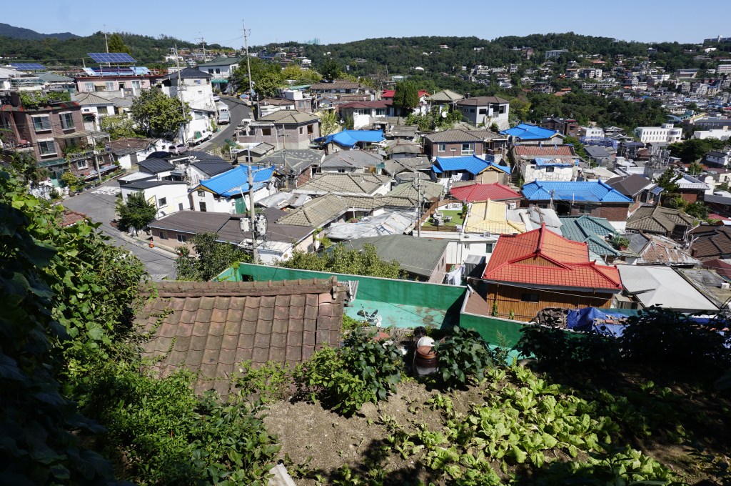
북정마을을 멀리서 보면 먼저 눈에 들어오는 것은 개별 건축물이 아니라 지붕의 무리다. 집들은 북악산의 경사에 맞추어 서로 다른 높이에 놓여 있고, 한양도성은 그 위쪽에서 마을의 경계를 이룬다. 같은 방향으로 정렬된 주택단지와 달리, 이곳의 집들은 주어진 터에 맞추어 조금씩 방향을 바꾸며 자리 잡았다.
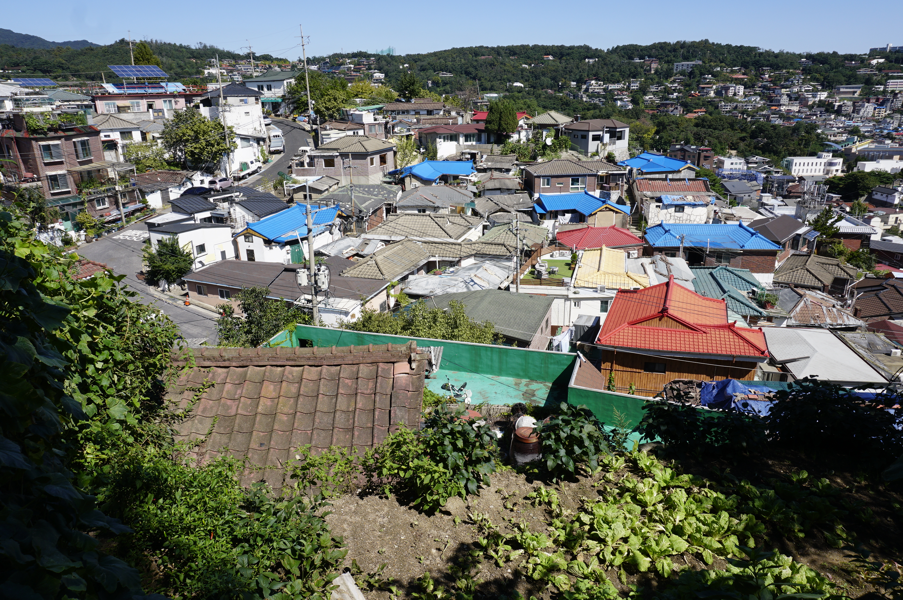
전경 사진에서는 회색 기와와 파란색·붉은색 지붕이 뒤섞인 마을의 윤곽이 보인다. 다른 방향에서 바라보면 나무와 경사지 사이로 낮은 주택들이 층층이 놓인 모습이 드러난다. 이것을 단순히 불규칙한 색채로 볼 필요는 없다. 집의 위치는 대체로 유지된 반면, 지붕의 재료와 색은 달라졌다. 오래된 기와 위에 칼라강판을 덮거나 새 지붕으로 교체한 수선의 결과다. 지붕의 색은 각 집이 노후화에 대응해 온 방식까지 보여준다.
산동네의 계단식 배치는 흔히 전망이나 채광의 장점으로 설명된다. 북정마을에서도 높낮이가 다른 집들은 앞집의 지붕 너머로 빛을 받아들인다. 다만 여기서 더 흥미로운 것은 집의 방향이 하나의 설계 원칙으로 정해진 것이 아니라, 기존 집과 골목, 햇빛과 진입 조건에 맞추어 오랜 시간 조정되었다는 점이다.
02. 중경 — 타원형 도로와 실핏줄 같은 속골목
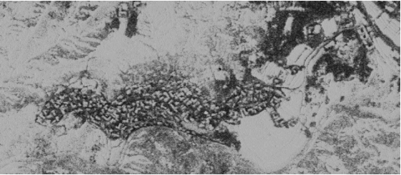
현재 북정마을의 형태를 가장 쉽게 알아보게 하는 것은 마을버스가 지나는 타원형 도로다. 그런데 이 도로는 마을이 생길 때부터 존재한 길이 아니다. 마을에 남은 준공기념 기록과 항공사진을 살펴보면 1983년 소방도로 조성이 시작되고, 1984년 일부 구간의 공사를 거쳐 2001년에는 오늘날과 같은 타원형 도로가 형성된 것을 확인할 수 있다.
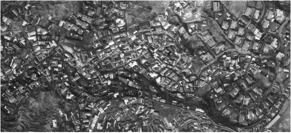
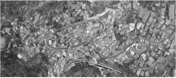
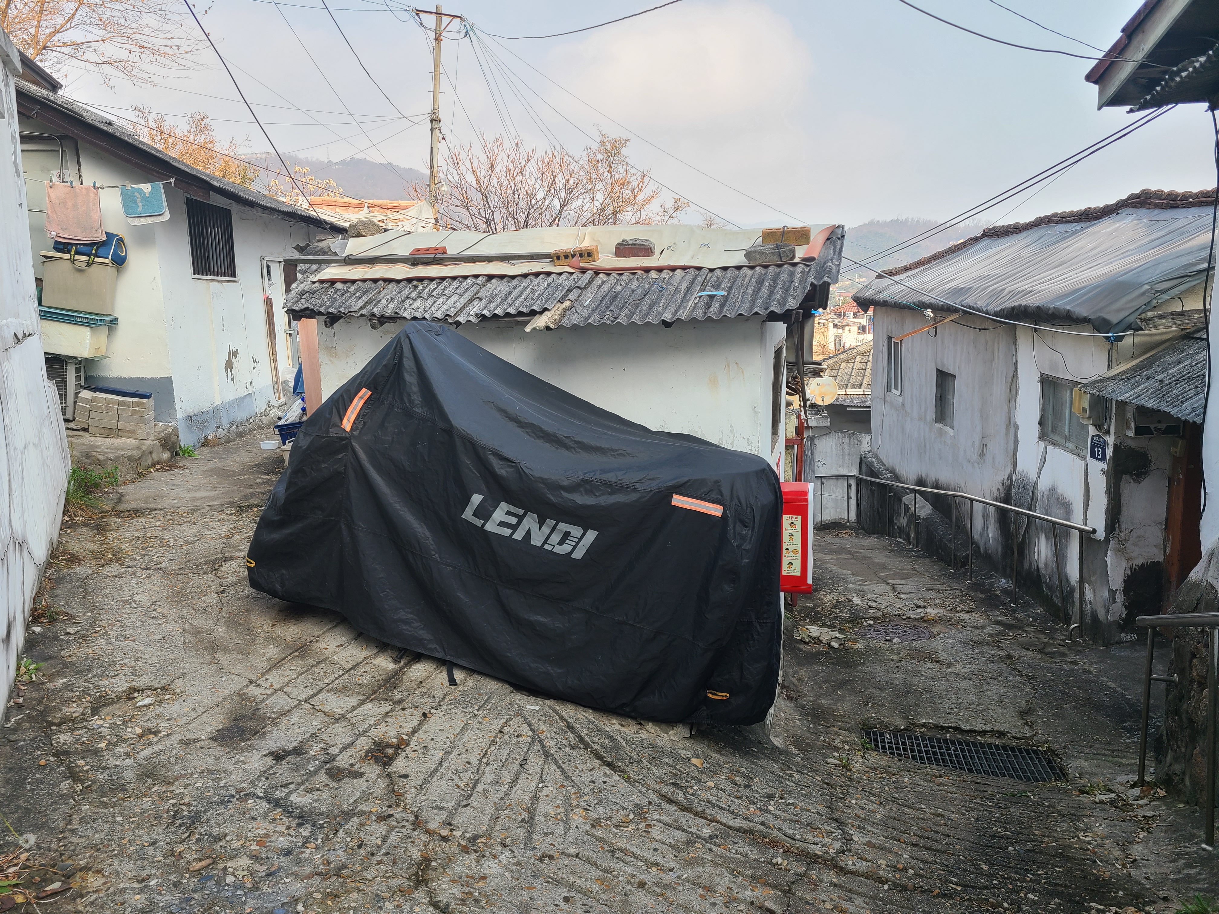
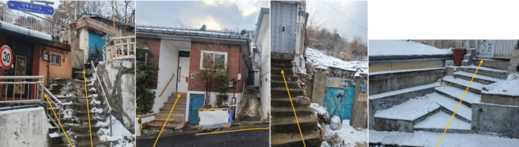
이 사실을 알고 길을 걸으면 풍경이 다르게 읽힌다. 차량이 다니는 큰길은 비교적 뒤늦게 들어온 구조이고, 그 안팎으로 뻗은 좁은 골목은 집들의 출입과 생활을 따라 만들어진 길이다.
큰길에서 골목으로 들어서면 보행의 방식부터 바뀐다. 도로에서는 차와 사람의 움직임을 함께 살펴야 하지만, 좁은 골목에서는 담장과 대문을 가까이 지나고, 몸의 방향을 틀어 계단을 오른다. 한 사람이 겨우 지나는 길도 있고, 짧은 계단을 지나 다시 다른 골목과 만나는 곳도 있다. 이 길들은 경사면에 집을 짓기 위해 필요한 접근로이면서 동시에 이웃이 마주치는 일상의 장소였다.
03. 근경 — 대문과 마당에 남은 생활의 흔적
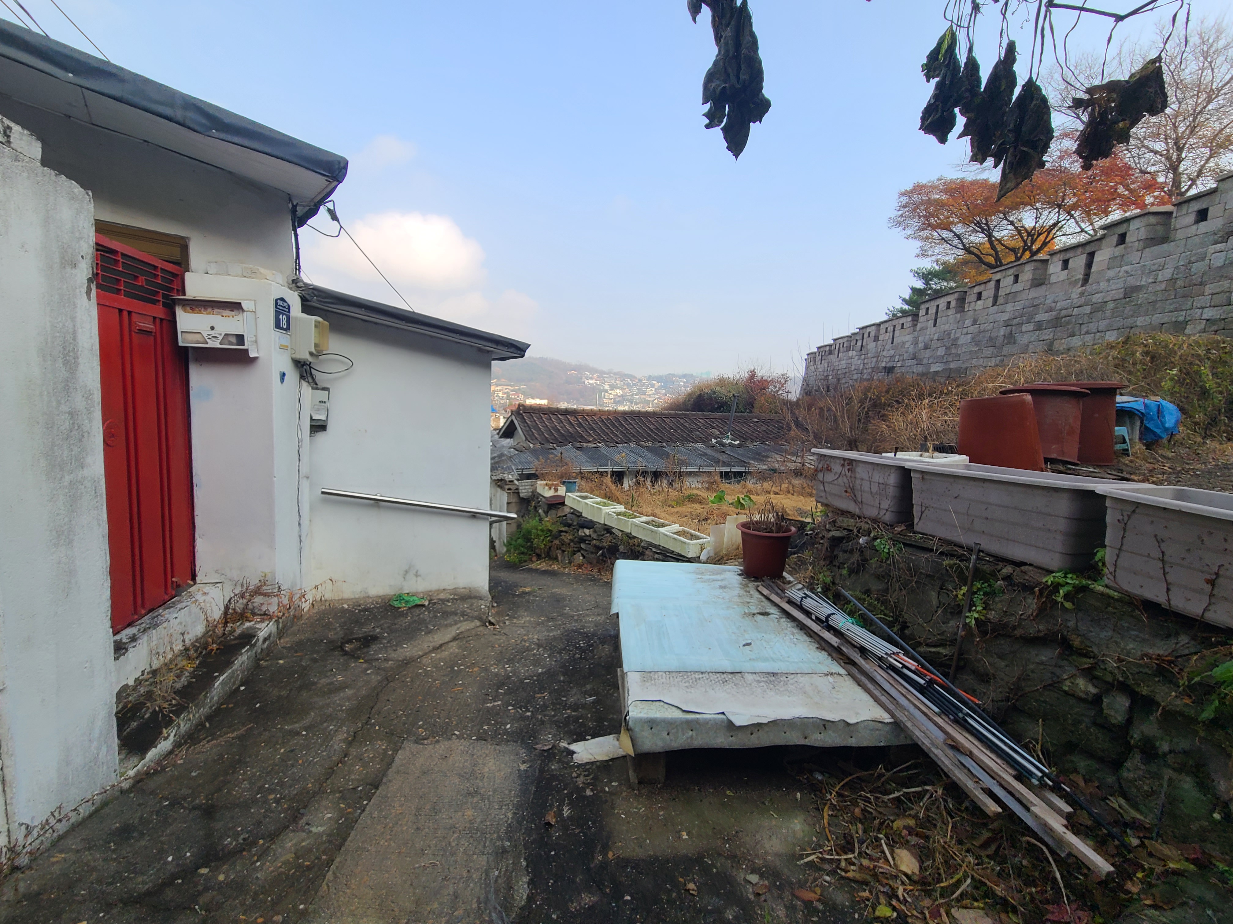
북정마을의 골목을 자세히 살펴보면 대문과 담장, 주택의 작은 마당에 눈길이 간다. 대문을 지나 안쪽으로 시선을 옮기면 낡은 창틀과 지붕, 마당을 채운 식물처럼 수선과 사용의 흔적이 드러난다. 길은 여러 사람이 공유하지만, 계단 몇 단을 오르는 순간 한 가구의 영역에 가까워진다. 공적인 길과 사적인 집 사이에 별도의 넓은 전정이 없어도, 높이 차와 진입 방향만으로 경계가 만들어지는 셈이다.
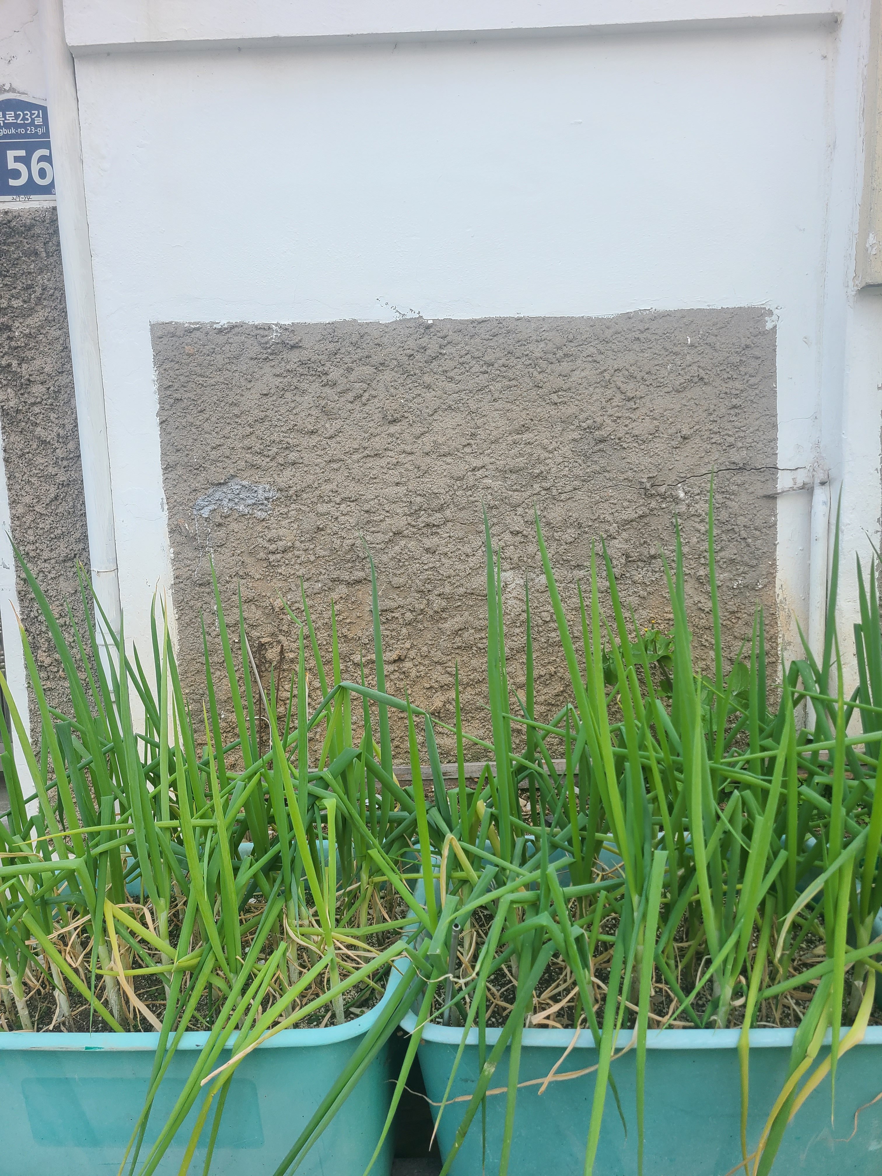
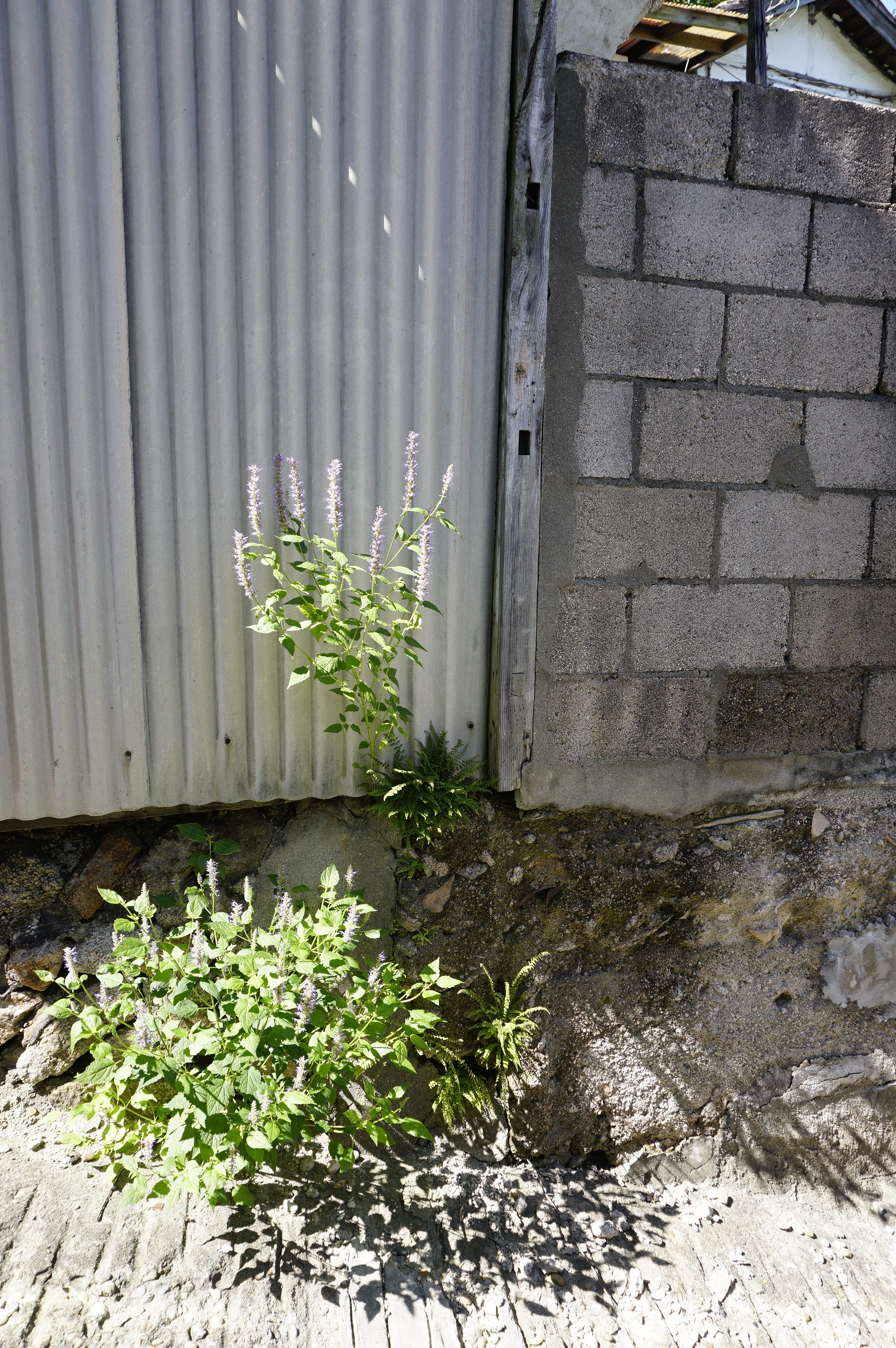
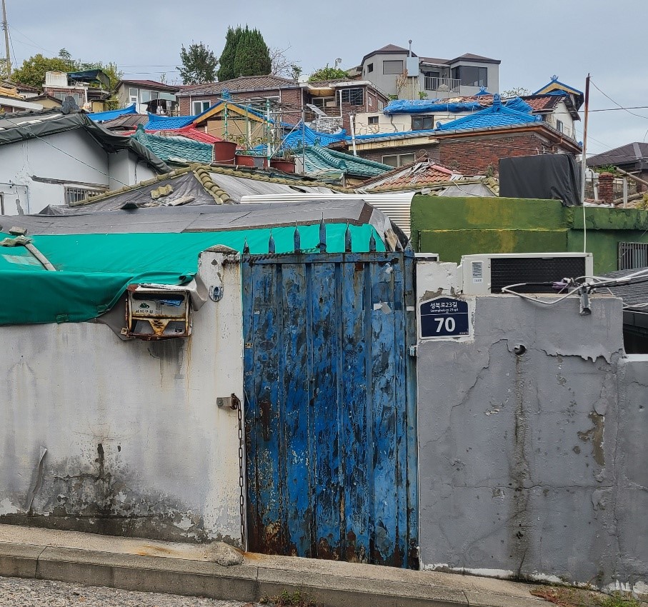
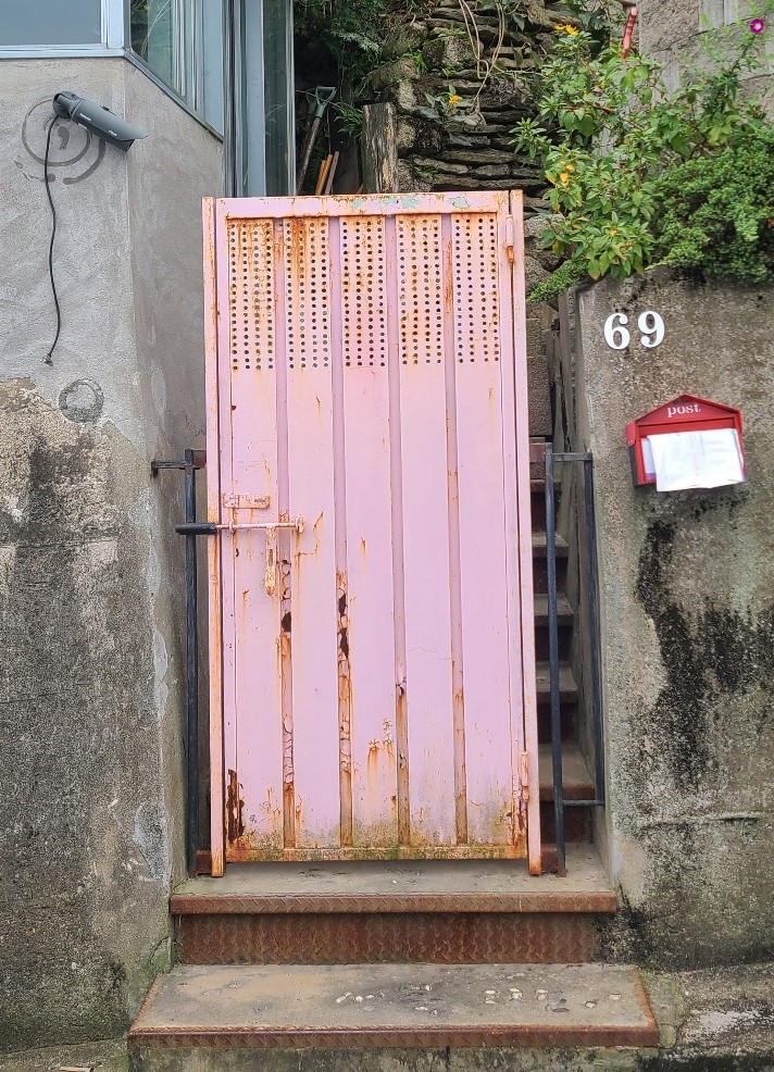
대문 앞에서도 칠은 한 수선 흔적을 볼 수 있다. 대문과 담장의 재료가 다르고, 그 너머의 지붕은 기와와 금속판이 뒤섞여 있다. 하나의 건물이 한 번에 완성된 모습이라기보다 필요한 부분을 고치고 덧붙인 시간이 겹쳐 보인다. 북정마을의 건축을 이해할 때 중요한 것은 처음 지어졌을 때의 형태만이 아니라 이후의 변화다.
주택의 기본 평면은 ㄱ자, ㄴ자, ㄷ자, 일자형 등으로 구분할 수 있지만 실제 생활은 그 안에서 멈추지 않는다. 마당 일부를 실내로 들이거나 복도를 넓히고, 출입구 앞에 작은 전실을 만드는 변화가 반복된다. 집을 사용하는 사람이 달라지고 생활에 필요한 기능이 생기면 공간도 조금씩 바뀐다.
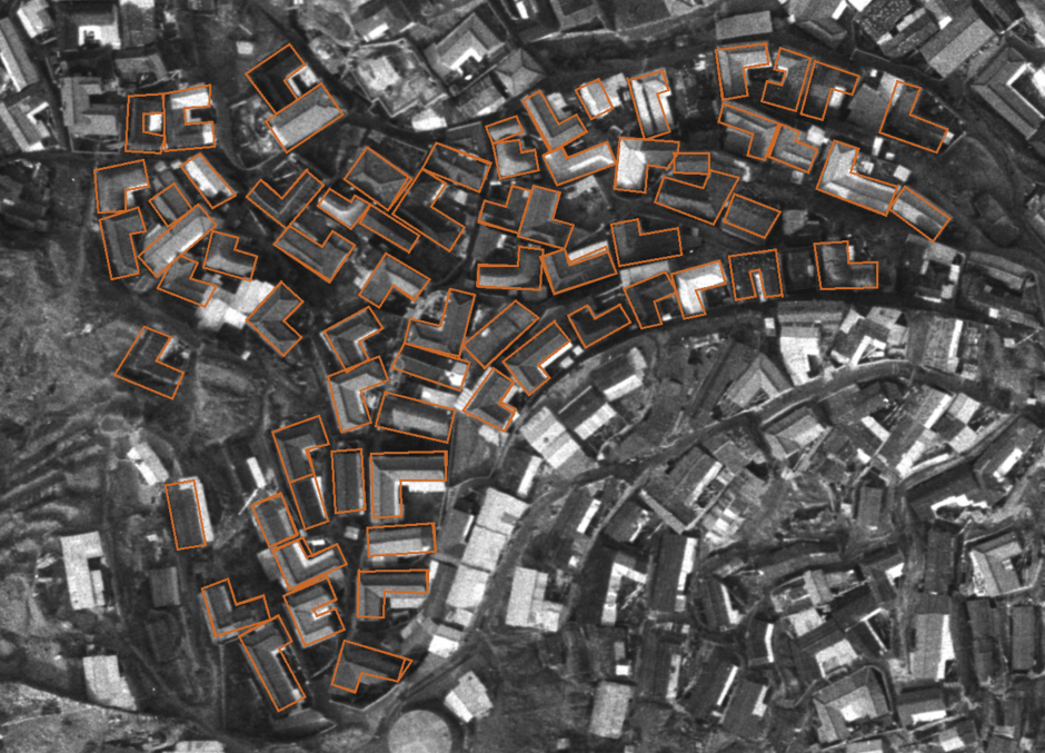
이러한 모습을 석사논문에서는 건축가 N. J. 하브라켄의 건조환경 개념으로 해석했다. 하브라켄은 건축을 설계자가 완성한 고정된 결과물로만 보지 않고, 사용자가 참여하며 지속적으로 변형되는 환경으로 이해했다. 북정마을에서는 경사진 땅과 골목이라는 비교적 오래 지속되는 구조 위에서, 집주인들이 지붕·창·마당·출입구를 각자의 필요에 따라 바꾸어 온 모습을 확인할 수 있다.
집의 경계는 대문에서 끝나지 않는다. 담장 아래 놓인 화분과 작은 의자, 성곽 아래 자투리땅의 텃밭은 집 안의 생활이 길 쪽으로 조금씩 확장되는 장면이다. 누구의 땅인지 선을 긋는 것만으로 설명되지 않는 사용의 영역이 생긴다. 북정마을에서 골목을 걷는 재미는 바로 이런 작은 차이를 발견하는 데 있다.
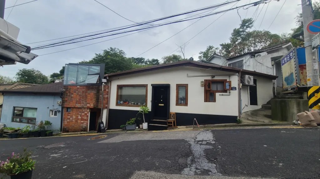
도로에 접한 집 중 일부는 주거와 작업공간을 함께 사용하거나 전시공간으로 바뀌기도 했다. 큰길에서는 방문자의 접근이 쉽기 때문에 창과 출입구를 넓히는 변화가 나타난다. 반면 깊숙한 속골목에서는 대문과 담장으로 사생활을 지키는 구조가 더 두드러진다. 같은 주택이라도 어떤 길을 마주하느냐에 따라 외부와 관계 맺는 방식이 달라지는 것이다.
맺으며 — 같은 골목에서 달라진 것
처음 북정마을을 걸었던 때와 최근의 모습을 비교하면 전체적인 골격은 여전히 익숙하다. 타원형 도로는 같은 자리를 돌고, 높은 곳으로 향하는 계단과 속골목도 남아 있다. 그러나 그 사이에서 생활의 밀도는 달라졌다. 최근 방문에서는 사람이 살지 않는 집이 늘어난 모습과, 훼손된 벽체나 담장을 확인할 수 있었다.
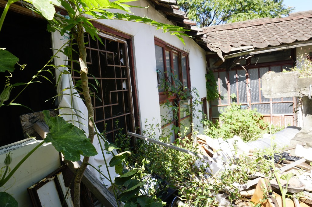
빈집은 단지 한 채의 건물이 비었다는 뜻에 그치지 않는다. 그 집으로 향하는 계단을 오르내리는 사람이 줄고, 대문 앞에서 이어지던 작은 움직임도 사라진다. 반대로 집이 비어도 골목과 계단, 담장은 남아 그곳에 어떤 생활이 있었는지 짐작하게 한다. 건축물의 형태가 유지되는 것과 생활공간이 유지되는 것은 같은 일이 아니다.
북정마을은 오랫동안 재개발을 논의해 온 지역이다. 앞으로 어떤 방식으로 달라지든, 기존의 길과 주택이 지형에 대응해 만들어 낸 관계는 이 마을을 이해하는 중요한 단서다.
나는 이 마을의 오래된 모습을 단순히 보존해야 할 풍경으로만 생각하지 않는다. 지붕이 바뀌고, 마당이 확장되고, 주택 일부가 작업실이 되는 과정도 북정마을의 역사다. 다만 집과 골목이 서로 영향을 주고받으며 변화해 온 방식까지 사라진다면, 같은 자리에 새로운 건물을 세워도 이전의 마을과는 다른 공간이 될 것이다.
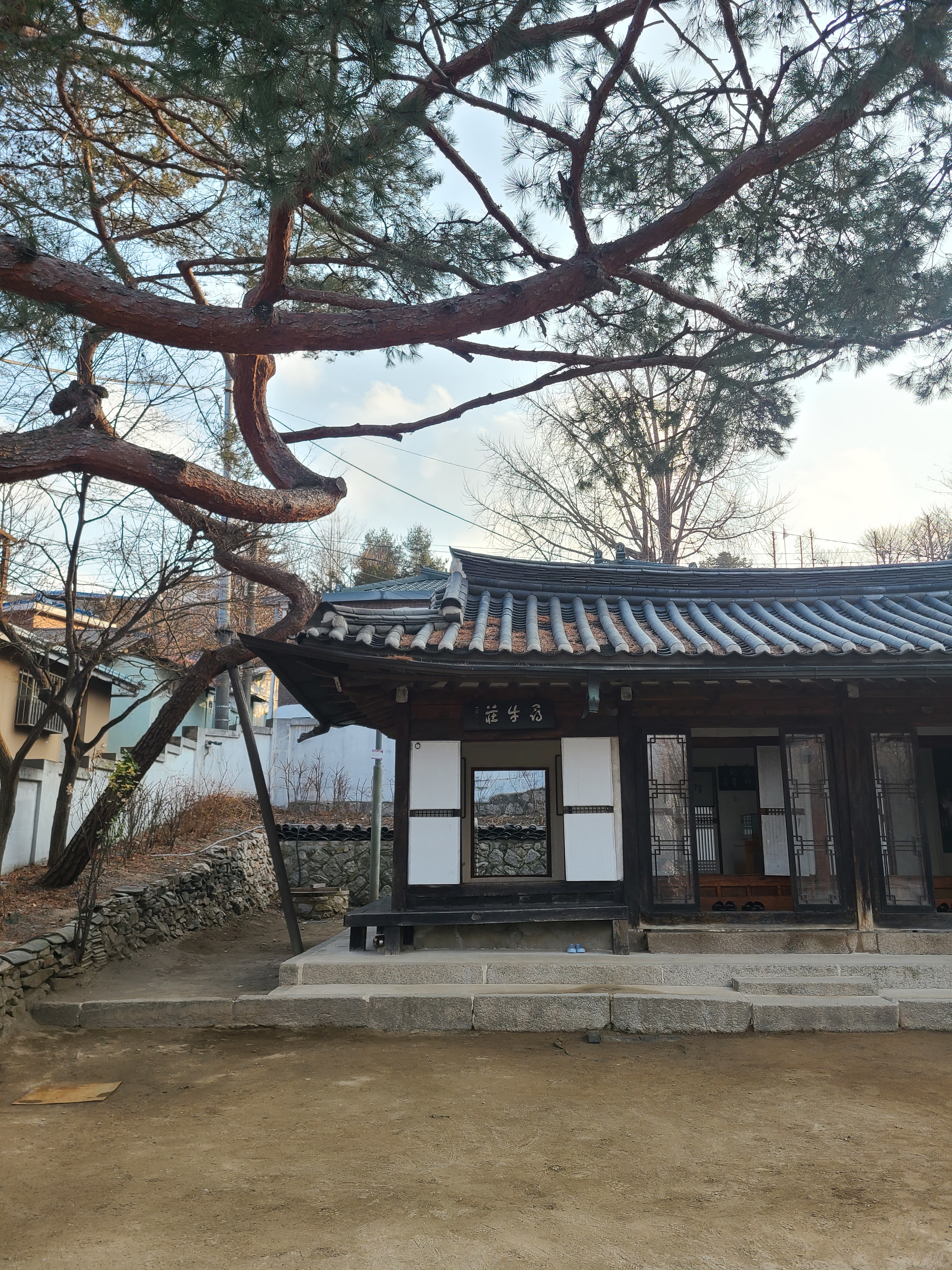
더 읽기 — 북정마을을 연구한 기록
이 글은 북정마을을 현장에서 관찰한 기록과 석사학위논문 「N. J. 하브라켄의 건조환경 개념을 적용한 성북동 북정마을 재생 계획」(2026)을 바탕으로 작성했다. 논문에서는 마을의 지형, 도로와 골목, 주택의 변형을 분석하고 기존의 공간 질서를 존중하는 재생 방향을 제안했다.
RESEARCH & EDUCATION · 연구 소개 보기 →
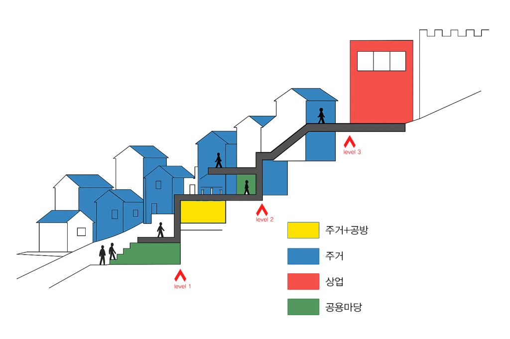
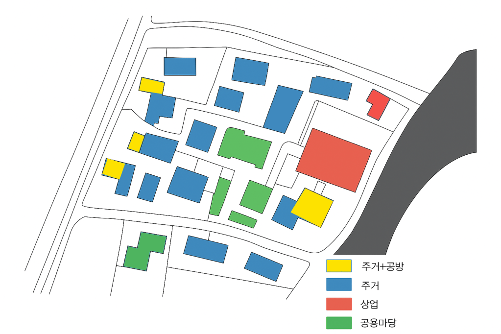
입지에 따른 주거공간의 기능적 확장 — 기존 주거 기능을 유지하면서 타원형 도로, 내부 골목, 한양도성과의 인접 관계에 따라 작업실과 상업공간 등으로 확장될 가능성을 탐색한 설계 개념도.
Adaptive Residential Uses Across Three Spatial Levels — Conceptual diagrams exploring how homes may accommodate studios and commercial spaces while retaining their residential function in response to their location.
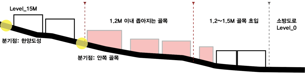
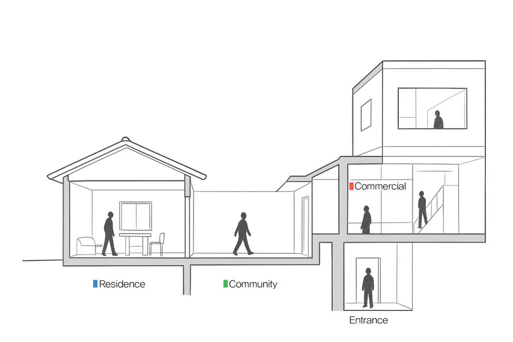
길의 단면 — 공적 공간에서 사적 공간으로의 전이 — 길의 폭과 높이 차이가 형성하는 주거 진입부의 공간적 경계를 나타낸 단면도.
Street Section — Public–Private Transition. A sectional study of how path width and changes in elevation shape the boundary between shared alleys and private homes.
출처: 이정옥(2026), 석사학위논문.
EN · Bukjeong Village: Houses Shaped by the Hillside
Bukjeong Village lies beneath Bugaksan, just outside Hanyangdoseong (the Seoul City Wall). Walking through its narrow alleys today, one encounters low houses, tiled roofs, and weathered walls. Yet the village cannot be understood through its present appearance alone. The area beyond the old city wall was not empty: its history includes everyday life outside the capital, places associated with writers and cultural figures during the Japanese colonial period, and the development of housing for urban workers following the Korean War. Simujang, the home associated with Han Yong-un, remains within the village. These histories do not describe every house in the same way, but they help explain why Bukjeong is more than a collection of hillside dwellings. I have walked through the village repeatedly for about ten years. What first drew my attention was the view of rooftops and alleys spreading across the slope. While preparing my master’s thesis, I began to look more closely at how the position of each house, the direction of a path, and the steps leading to a gate reveal people’s responses to the terrain.
Distant View — Houses Between the Mountain and the City Wall. From afar, Bukjeong appears less as a collection of individual buildings than as layers of rooftops. Houses stand at different elevations along the slope of Bugaksan, with Hanyangdoseong defining the upper edge of the village. Unlike a housing development arranged along a single axis, these homes face slightly different directions, responding to the ground available to them. Gray tiles, blue and red roofs, and low houses among trees create a varied landscape. Some roofs have been repaired or replaced, while the positions of the houses have largely endured. The stepped arrangement can bring sunlight over neighboring rooftops, but it also records a longer process of adjustment: each house has had to negotiate its relationship with nearby buildings, alleys, access routes, and light.
Middle View — The Oval Road and the Inner Alleys. One of Bukjeong’s most recognizable features is the oval road used by the village bus. It was not part of the village from the beginning. Records and historical aerial photographs examined in the Korean article show that construction of a fire-access road began in 1983, continued through sections completed in 1984, and had taken the familiar oval form by 2001. Knowing this changes how the village is read on foot. The road carrying vehicles is a comparatively recent addition, while the narrow alleys extending around and within it follow the access needs of individual houses. Moving from the road into an alley changes the scale of experience: one passes close to walls and gates, turns to climb steps, and sometimes follows a passage barely wide enough for one person. These routes provide access across steep ground, but they are also places where neighbors encounter one another in everyday life.
Close View — Gates, Courtyards, and Everyday Adaptations. At the scale of a house, Bukjeong’s spatial character becomes visible in its gates, walls, courtyards, and stairs. A shared alley may lead directly to a few steps and then to a private entrance; changes in elevation and direction create a gradual boundary even without a large front yard. Repairs and additions are visible in painted gates, mixed wall materials, altered windows, and roofs combining tiles with metal sheets. Houses may have straight, L-shaped, or courtyard-oriented plans, but their use does not remain fixed. Residents have enclosed parts of courtyards, widened passages, and adjusted entrances to meet changing needs. In my master’s research, I examined these changes through N. J. Habraken’s concept of the built environment: buildings are not simply finished objects designed once, but environments that continue to change through use. The terrain and alleys form relatively enduring conditions, while residents adapt roofs, windows, courtyards, and entrances over time. Flowerpots, small chairs beside walls, and garden plots near the city wall also show how domestic life extends toward shared space. The boundary between home and alley is therefore not always defined by a property line alone.
Adaptive Residential Uses — A Design Exploration. Some houses along the road already combine residential and working functions, while others have been adapted for exhibition use. A house facing a more accessible road relates to visitors differently from one reached through a narrow inner alley, where gates and walls provide greater privacy. The three conceptual diagrams extend this observation into a design proposal. They distinguish homes near the oval road, within the inner alleys, and beside Hanyangdoseong, exploring how each location might accommodate a different degree of change. The intention is not to replace housing with commercial development. It is to retain residential use while considering whether parts of a home could also function as a studio or commercial space in response to its setting and contemporary ways of living. A separate street-section drawing from my thesis examines how differences in path width and elevation shape transitions between public and private areas. The conceptual diagrams and the analytical section serve different purposes: one explores possible future uses, while the other studies existing spatial relationships.
Closing — What Has Changed Along the Same Paths. When I compare my earlier walks with more recent visits, the village’s overall structure remains familiar. The oval road follows the same route, and the stairways and inner alleys still climb the hillside. Yet the life within this framework has changed. I have seen more unoccupied houses, as well as damaged walls and building surfaces. An empty house is more than a vacant structure: fewer people use its steps, and the small daily movements around its gate disappear. Even when a house is no longer occupied, the alley, stairs, and walls remain as traces of earlier life. Preserving the physical form of a place is not necessarily the same as sustaining it as a lived environment. Bukjeong has long been the subject of redevelopment discussions. Whatever changes come next, the relationships among terrain, paths, and homes are essential to understanding the village. I do not see its older buildings as scenery that must remain unchanged. Repaired roofs, expanded courtyards, and homes partly adapted as workspaces are also part of its history. What matters is whether future changes can recognize the ways houses and alleys have shaped one another over time.
Research Note. This article draws on my field observations and my 2026 master’s thesis, “A Regeneration Plan for Bukjeong Village in Seongbuk-dong Applying N. J. Habraken’s Concept of the Built Environment.” The research examined the village’s terrain, roads, alleys, and alterations to houses, and proposed a regeneration approach attentive to its existing spatial order.


답글 남기기